High and Low on Mars [1]
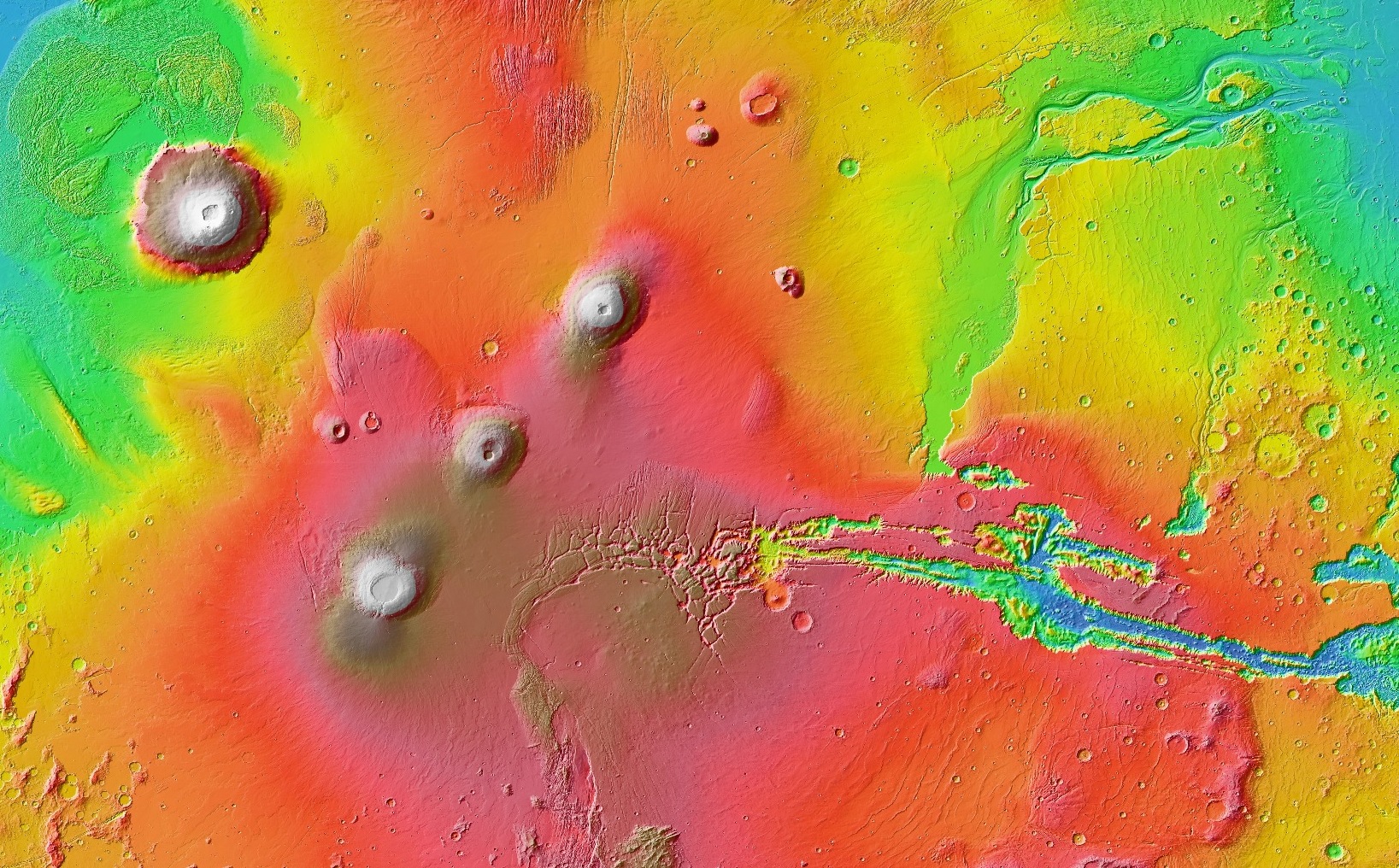
A color-coded map shows the Tharsis region of Mars, home to the planet's largest volcanoes and deepest canyon. Red and brown represent the highest elevations, while green and blue are the lowest. This view encompasses Olympus Mons, at top left, the largest volcano on Mars. To its lower right are the three peaks known as Tharsis Montes. From lower left, they are Arsia, Pavonis, and Ascraeus Mons. A series of canyons known as Valles Marineris stretch across the right of the image, cutting deep into the landscape. Valles Marineris is many times longer, wider, and deeper than the Grand Canyon. [NASA/JPL/Arizona State]